TL;DR
Geographic information systems and remote sensing are important tools used by environmental professionals to collect, analyze, and interpret environmental information. These technologies support site investigations, contamination assessments, environmental monitoring, and remediation planning. Students in environmental technology programs learn how to combine fieldwork, data analysis, and modern mapping tools to solve real-world environmental challenges.
Environmental decisions rely on accurate information. Whether assessing soil contamination, monitoring water quality, or planning remediation projects, environmental professionals need reliable data to understand what is happening on a site.
That is why geographic information systems and remote sensing have become essential tools in modern environmental work. For students entering environmental technology, these technologies provide powerful ways to collect, visualize, and analyze environmental information.
What Are Geographic Information Systems and Remote Sensing Used for in Environmental Technology?
Environmental professionals use GIS and remote sensing technologies to support environmental data collection, mapping, monitoring, and environmental site assessments.
What are geographic information systems used for in environmental technology?
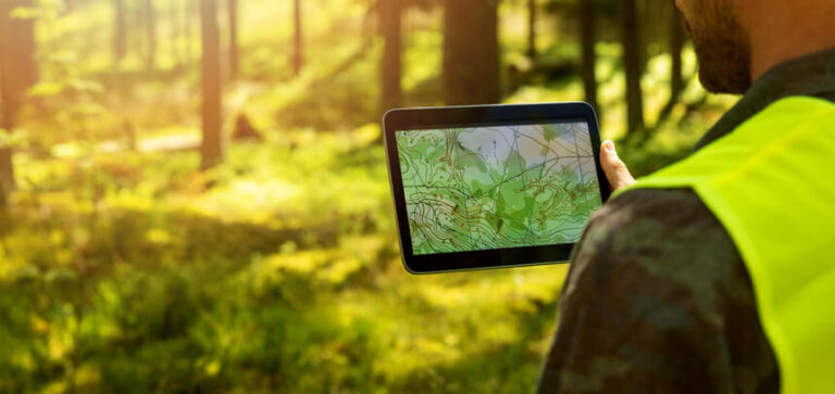
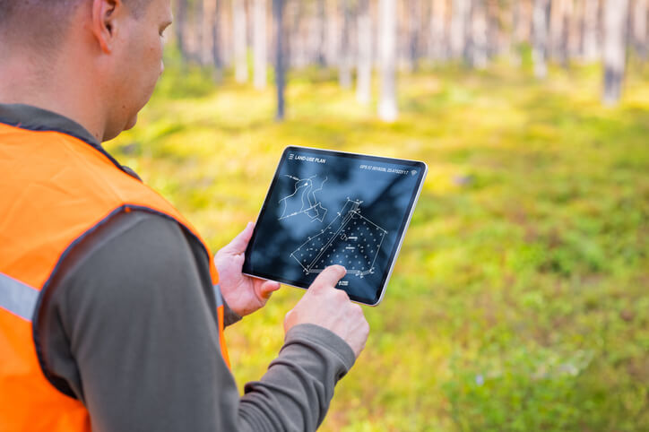
Geographic Information Systems (GIS) are used to collect, organize, analyze, and display environmental data in map-based formats.
GIS allows environmental professionals to visualize information such as land use patterns, groundwater conditions, contamination zones, vegetation coverage, and infrastructure locations. By combining multiple layers of information, technicians can identify patterns and make more informed decisions.
Students enrolled in the Applied Environmental Technology Diploma Program learn how GIS supports environmental investigations, project planning, and regulatory compliance activities.
What Is Remote Sensing in Environmental Science?
Remote sensing is the process of collecting environmental information from a distance using satellites, drones, aircraft, or other sensor technologies.
In remote sensing environmental science, sensors gather information about land, water, vegetation, and environmental conditions without requiring direct physical contact. These technologies help environmental professionals monitor large areas efficiently and identify changes over time.
Remote sensing is commonly used for:
- Land-use analysis
- Habitat monitoring
- Water resource assessment
- Vegetation mapping
- Environmental change detection
When combined with GIS, remote sensing creates powerful tools for environmental analysis and decision-making.
What Is an Environmental Site Assessment and Why Is It Important?
An environmental site assessment evaluates a property’s environmental condition to identify actual or potential contamination risks.
Environmental site assessments are often conducted before property transactions, redevelopment projects, industrial activities, or remediation efforts. These assessments may involve historical research, site inspections, sampling activities, and laboratory analysis.
Environmental technicians play an important role in gathering data, documenting findings, and supporting environmental investigations. Strong site assessment practices help protect public health, natural resources, and regulatory compliance.
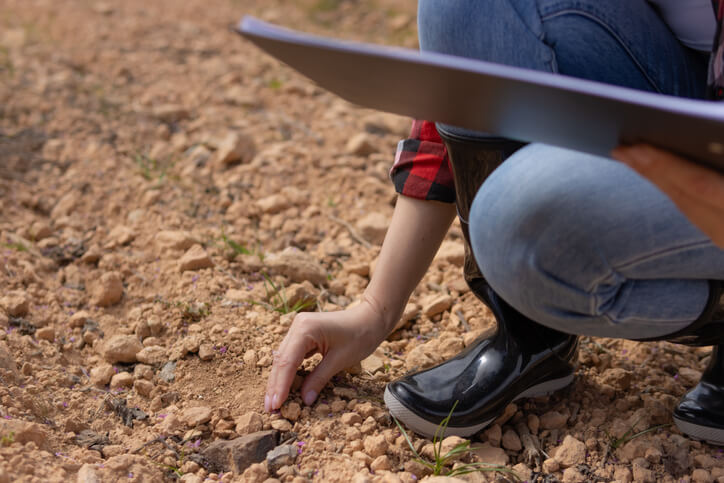
How Do Environmental Technicians Collect and Analyze Field Data?
Environmental technicians collect samples, perform field measurements, document site conditions, and analyze information using specialized tools and software.
Common forms of environmental data collection include:
- Soil sampling
- Groundwater testing
- Surface water monitoring
- Air quality measurements
- Noise monitoring
- Site inspections
The Applied Environmental Technology Diploma combines classroom instruction with hands-on field investigations, helping students gain practical experience with sampling methods, data interpretation, and environmental reporting. These skills are valuable across many environmental monitoring careers and consulting roles.
What Do Students Learn in an Environmental Technology Diploma Program?
Students learn environmental science principles, site assessment methods, pollution control strategies, data analysis techniques, GIS applications, remote sensing technologies, and regulatory requirements.
The Bay River College program includes training in:
- Environmental chemistry
- Soil and groundwater contamination assessment
- Water and wastewater treatment
- Air and noise pollution control
- Risk assessment and remediation
- GIS and remote sensing technologies
- Environmental monitoring and compliance
Students also complete 200 hours of practicum experience, helping them build workplace skills and prepare for an Environmental Technician Career Path in Canada.
According to the Government of Canada Job Bank, environmental and conservation technicians support environmental monitoring, site investigations, sampling activities, and compliance initiatives across a variety of industries. Learn more about environmental technician career outlooks and responsibilities on the Government of Canada Job Bank.
Do you want more information about the training methods of career colleges? Explore our comprehensive guide on What Are Career Colleges?
Building Practical Environmental Technology Skills
Today’s environmental professionals rely on both field experience and technology. From conducting site investigations to interpreting GIS maps and remote sensing data, technicians must be able to collect accurate information and transform it into actionable insights.
For students considering environmental careers, learning geographic information systems and remote sensing provides valuable skills that support environmental assessment, monitoring, remediation, and sustainability initiatives across many industries.
Are you looking for a comprehensive Applied Environmental Technology Diploma Program?
Contact Bay River College for more information.
Key Takeaways
- Geographic information systems and remote sensing help environmental professionals collect and analyze environmental information.
- GIS supports mapping, site investigations, and environmental decision-making.
- Remote sensing environmental science uses satellites, drones, and sensors to gather environmental data.
- An environmental site assessment helps identify contamination risks and supports remediation planning.
- Environmental technicians perform field sampling, testing, and environmental data collection activities.
- Environmental technology programs prepare students for a variety of environmental monitoring careers.
FAQ
What Are Geographic Information Systems Used for in Environmental Technology?
Geographic Information Systems are used to collect, organize, analyze, and display environmental data in map-based formats.
What Is Remote Sensing in Environmental Science?
Remote sensing is the process of collecting environmental information from a distance using satellites, drones, aircraft, or other sensor technologies.
What Is an Environmental Site Assessment and Why Is It Important?
An environmental site assessment evaluates a property’s environmental condition to identify actual or potential contamination risks.
How Do Environmental Technicians Collect and Analyze Field Data?
Environmental technicians collect samples, perform field measurements, document site conditions, and analyze information using specialized tools and software.
What Do Students Learn in an Environmental Technology Diploma Program?
Students learn environmental science principles, site assessment methods, pollution control strategies, GIS applications, remote sensing technologies, environmental monitoring, and regulatory compliance.